Maps of Torun and its neighbourhood


Click on a map or a filename to see (or download) a high resolution version.
Note that these are usually quite large files.

OkolTorunia.jpg
OkolTorunia.jpg, 1.89 MB
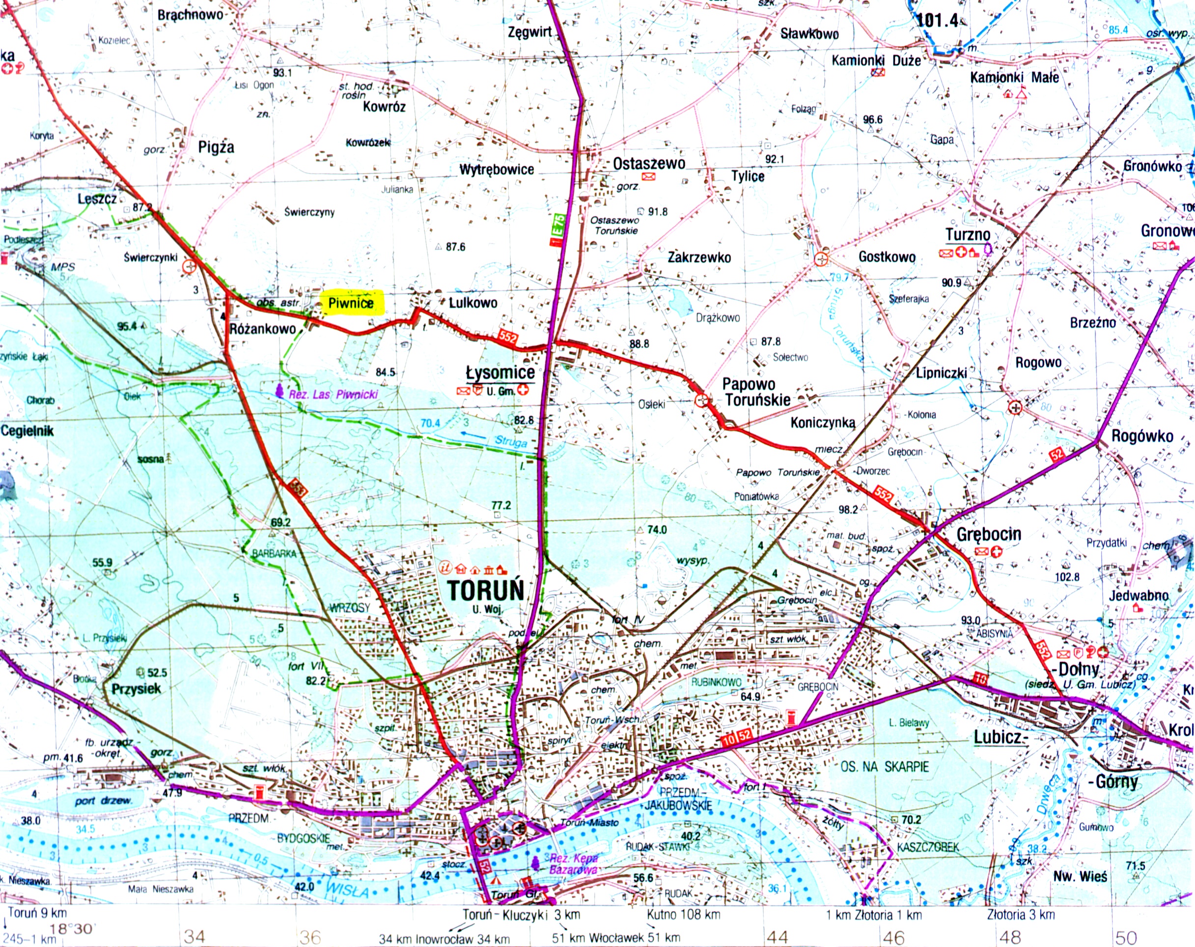
The map to the left shows the Piwnice village (marked; top left quarter of the image), where the TRAO is located, relative to the Torun township. Note that the road numbers are now invalid (they were changed in the first half of September 2000; basic information is given here). See also another map here.


Tor-plan.jpg
Tor-plan.jpg, 1.65 MB
Tor-Legenda.jpg
Tor-Legenda.jpg, 384 KB
Detailed map of Torun (right) with a legend. If you come to us by train, most likely you will get off at the Torun Glowny (i.e. Main) station (bottom center of the map). There is a taxi and bus stop closeby, just outside the station. You can take bus No. 22 to get to Helios hotel (bus tickets are available in kiosks for less than 2 zlotys for any distance, any daytime line (tram or bus); do not forget to check the ticket inside the bus). Should you travel by "Polski Express" bus from Warsaw, you'll get off it by Szosa Chelminska street, between Czerwona Droga - Odrodzenia street and Waly Gen. Sikorskiego street. Your Hotel (Helios) is a walking distance away, by Plac Niepodleglosci (at the junction of three streets: Czerwona Droga, Kraszewskiego and Aleja Jana Pawla II).


centrum.gif
centrum.gif, 76.60 KB
Tor-centr.jpg
Tor-centr.jpg, 1.10 MB
Left above: Schematic map of communication lines in central part of Torun. The tram lines are in red, daylight buses - in black, and night buses - in blue. Right: Torun - Old Town part.


For more details about Torun see this town home page.

To TOG 2009 page or to TRAO page
Prepared by KB (Sept. 2000).